Tag Archives: Adventure

A scenic road-trip along the Swedish south coast – 2025

Earlier this spring, Saturday 29 March, I had the pleasure of taking three visiting friends from India, Gowtham, Mohan and Sanath. on a road trip along the south coast of Skåne, to share a few glimpses of Swedish culture and nature, and to enjoy good conversations along the way.

We began our trip at Emporia [1], one of the largest shopping centers in Scandinavia with around 180 shops and restaurants. The modern architecture, with its stunning curved glass entrances – an amber-colored and a blue, is designed by Wingårdh Architects and opened in 2012.

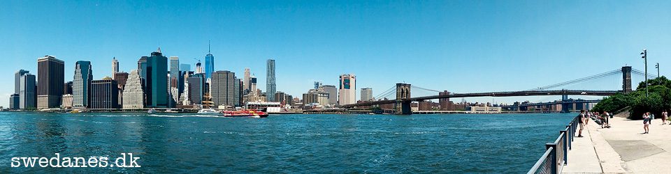
The Emporia rooftop viewpoint offering panoramic views of Malmö and the Öresund Bridge. The viewpoint sits at approximately 65 meters above sea level and providing a beautiful view, in clear weather 🙂


First stop on the trip was Skanör [2] and Falsterbo [3], 34 km southwest from Malmö. These two idyllic seaside towns are known for their white sandy beaches and pastel-colored beach huts that only the locals, living in the municipality, can buy for around 200.000 SEK. Many are also inherited, to keep in the family. 

“It was super cold during the first couple of days—too cold for an Indian like me! But by the time of the trip, I had adjusted enough that Sanath and I even walked into the beach water and took a few photos. Luckily, it was a sunny day, which made things better.” (Mohan)

The area was once a bustling medieval trading hub, today, these towns are a tranquil escape, offering some of Sweden’s finest beaches, birdwatching opportunities, and even a touch of luxury.

In the area you also find Falsterbo Golf Club, one of Sweden’s oldest golf courses, established in 1909,  offering a fantastic course with beautiful views.

Falsterbo Horse Show that each summer hosts one of the world’s most prestigious equestrian events.

Sweden’s oldest nature reserve, Måkläppen Sanctuary, open for visitors between 1 November – 31 January. Here you can enjoy bird watching and and wild seal spotting.


Continuing eastward along the scenic coastline, we reached Smygehuk [4] (47 km from Malmö), the southernmost point of Sweden and the entire Scandinavian Peninsula. 

The area features Smygehuk Lighthouse that dates back to 1883. During the summer months, there are lots of activities – music, art, culture, and shopping. The winter offers clean, crisp air, spectacular sunsets.

The viewpoint Utkiken is a platform that marks the southernmost point in Sweden, from which one can see Köpmansmagasinet, dating from the early 19th century. Rumor has it that it was once a smuggler’s nest during the Napoleonic Wars. There is a signpost pointing to places such as Berlin, Copenhagen, Stockholm, and the North Pole.

We enjoyed lunch at Sweden’s southernmost café, Café Smyge, with their famous prawn sandwich,

“Lunch at Café Smyge was something new—I couldn’t really figure out the food, but it was interesting! Luckily, we found some Indian food in the evening. I was happy—spicy food always hits the spot.” (Mohan)


After lunch we followed the coastline to Ystad Saltsjöbad [5], about 65 km from Malmö. This elegant luxurious spa resort offers a charming and classic Newport-style experience with sea views, delicious food, and a relaxing spa. The resort has a rich history dating back to the 19th century and is situated just 20 meters from the sea, providing an excellent location for a getaway.

Ystad itself is famous for its medieval streets and as the setting for Henning Mankell’s Wallander crime novels.


Our final stop along the south coast was Ales Stenar [6] (80 km from Malmö), a 1,400-year-old Viking stone ship located on a hill overlooking the sea. Composed of 59 massive boulders weighing up to 5 tonnes each, this mysterious monument is one of Sweden’s most fascinating historical sites. Whether it was used as a burial ground or a solar calendar remains a mystery, but the view from here is breathtaking, especially at sunset.

“At Ales Stenar, the sea view was beautiful. Me and Sanath climbed down from Kåseberga ridge to the seashore and caught a peaceful sunset while walking on the stones near the water.” (Mohan)


Returning to Malmö, we ended our journey at Möllevångstorget [7], a lively square in the heart of the city. Known for its fruit and vegetable market, this area is a melting pot of cultures, packed with international grocery stores, Middle Eastern bakeries, and Asian supermarkets. It’s also home to some of Malmö’s best restaurants, including Kontrast, an Indian eatery serving rich, aromatic curries and flavorful tandoori dishes. My Indian guests approved the authenticity of the dishes 🙂


Gowtham’s “Top 5 things that stood out”:

  1. The roads were smooth, well-maintained, and there was barely any traffic. Everyone followed traffic rules, which made driving feel super calm and safe. Definitely a big contrast to the usual chaos we’re used to back home.
  2. Parking was super easy and organized, with proper spots everywhere. No random squeezing into tight spaces or stressful searches like in India.
  3. Since we were mostly in the countryside along the south coast, it was really quiet and not crowded at all. Most places had very few people around, which made the whole trip feel super relaxed.
  4. The weather was a bit chilly, but overall it was nice. The air felt fresh and clean, and there was zero pollution.
  5. The beaches we stopped by were really well-kept, with clean surroundings and crystal clear (and freezing!) water. Everything just felt very well-maintained and natural.

Mohan’s story:
“Overall, it was a really chill and refreshing experience—very different from the usual road trips in India.

I felt a bit anxious when I landed in Denmark since it was my first foreign trip, but also excited—the air was so fresh and welcoming, I felt like I had stepped into a European movie set.

The Sweden trip was a surprise! Gowtham bro casually told me and Sanath that we could go on a road trip with Ingo, and I was instantly in. I was already hoping to see the Danish countryside, so I was happy we were actually doing a road trip through peaceful, scenic routes.

It was super cold during the first couple of days—too cold for an Indian like me! But by the time of the trip, I had adjusted enough that Sanath and I even walked into the beach water and took a few photos. Luckily, it was a sunny day, which made things better.

I had stopped beach walking and hiking recently back home because of the crowds and poorly maintained spots. But here, it was the opposite—clean beaches, quiet roads, and no traffic. I even picked a few seashells and small stones for my girlfriend—she finds those things cute, and I didn’t want to return empty-handed!

At Ales Stenar, the sea view was beautiful. Me and Sanath climbed down from Kåseberga ridge to the seashore and caught a peaceful sunset while walking on the stones near the water.

Lunch at Café Smyge was something new—I couldn’t really figure out the food, but it was interesting! Luckily, we found some Indian food in the evening. I was happy—spicy food always hits the spot.

And finally, shoutout to Ingo—our 63-year-old young friend who drove more than 300 km like a pro. His energy was amazing. I hope I have that kind of enthusiasm when I reach his age!

I didn’t get much time to explore agricultural practices in Denmark and Sweden, which I’m actually interested in – but hopefully next time.”


Final thoughts
This road trip showcases the diversity of Skåne, from picturesque villages, golden beaches and ancient Viking landmarks to vibrant city culture and mouthwatering cuisine. Whether you’re a nature lover, history buff, or foodie, the southern coast of Sweden offers something special for everyone.


See previous posts about sightseeing in Skåne:

Hiking Skåneleden Kullaberg

Kullaberg is a rocky peninsula, located in northwestern Skåne, along the Kattegat coast, just a 1.2-hour drive north of Malmö. This area is famed for its stunning landscapes, dramatic cliffs, rich biodiversity, and world-class hiking opportunities.

After obsessively watching the weather forecast for days, I decided to tackle the Skåneleden Trail on Thursday, 25 July. This summer’s weather has been wildly unpredictable, but my decision paid off — the conditions were perfect.

The natural beauty and diverse landscapes of the Kullaberg Nature Reserve include winding pathways of trails with lush, towering beech forests, fascinating caves and dramatic coastline views.
 

Just outside the charming village center of Mölle, there is a free parking lot for hikers. The trail starts right next to a chapel, next to the parking lot. Following the orange and blue markers for the north coast.

The first goal, after some serious uphill effort, was Håkull, Kullaberg’s highest point at 187 meters above sea level. The panoramic view from the top is extraordinary, making the challenging hike up (and down) well worth it.

Next detour from the orange trail led me to Josefinelust Beach, named after King Oscar 1’s wife, Josefina, who fell in love with its beauty during a visit in 1865. This area doesn’t have a beautiful pebble beach; it’s also home to some of the caves this area is known for. Note: The path down and up is very steep, with a “stairway” providing some much-needed assistance.

At the very tip of the Kullaberg Nature Reserve stands the key landmark — Kullens Lighthouse. It’s one of the oldest and most powerful lighthouses in Scandinavia, having “Saved lives since 1561.” The current structure, built in the late 19th century, houses a museum and observation deck with fantastic panoramic views. Nearby, the Kullaberg Naturum Visitor Centre offers fun activities and engaging nature and animal exhibitions. One quirky feature was a cigarette voting box asking, “Which animal keeps it cleanest at home: Badger or human male?” 🙂 Another exhibit showcased birdhouses with various items and information on how long these items take to decompose in nature.

While exploring, my Garmin watch ran out of juice. I put it in my pocket with a power bank to charge, but after a kilometer or so, I noticed it was missing. Retracing my steps, I found it! Some kind soul had placed it on a rock in plain sight. Huge thanks to that awesome person!

The trail from the lighthouse back to Mölle, along the south side of the peninsula, is marked with red signs alongside Skåneleden’s orange markers. This section offers more coastal views than the forest trail on the north side.

Next, I reached Ransvik Beach, once notorious as a “stronghold of sin” because it was the first place in Sweden where men and women swam together.

After roughly 15 km, I arrived at the charming fishing village of Mölle. At the end of the pier in the small harbor, I treated myself to a well-deserved dinner at Systrarna på piren, enjoying a fantastic view of the village, sea, and sunset.

  • Difficulty: Varies from easy to challenging, with some (very) steep and rocky sections.
  • Terrain: Coastal cliffs, dense forests, meadows, and rocky shores.
  • Trail Markings: The Skåneleden Trail is well-marked with orange signs and information boards. North trail is marked blue and south is marked red.
  • Best Time to Visit: Spring and summer are the most popular seasons, with mild weather and longer daylight hours. Autumn also offers beautiful foliage and fewer crowds.

For maps and inspiration, check out Kullabergs Natur 


Canoe adventure and visit to Bäckaskog Castle

Monday 8 July I was invited by a friend to join a canoe trip on Holjeån, a small creek close to the village Näsum. We rented canoe and equipment from Wetlandi Canoe Center and started from Västanå Kvarn (mill).

Västanå Mill is one of the country’s oldest industrial facilities still in operation. Records (an invoice to the Danes) indicate that there has been a mill here since at least 1380. Although not as old, the stone bridge over the river just south of the mill is still impressive. The bridge is nearly 50 meters long, and since no traffic has been allowed since the 1950s, one can peacefully gaze over the river from the bridge.

Under the bridge we encountered our first challenge. When we should pass the small stream, I got the tip to try and “brake” as much as possible to avoid going to the right, that was apparently not a good idea. Maybe I braked too much since we went to the left and got suck on some rocks. Got loose and could continue to the next challenge. 

After approximately 1 km down river there was a log across the river, under water. Since the water level was quite low we could not pass over it without some extra work. Climbed on to the part of the log that was over water and could drag the canoe over. 

When entering Ivösjön the sky opened up and there was lots of rain, hale, wind, waves, thunder and lightning. Got a little nervous and we decided to paddle to the shore to take “shelter” (very limited but we were not on the lake). After half an hour it was gone and we could see the sun again and continue to the end station Klackabacken.

The distance from Västanå mill and Klackabacken is 7 km. A narrow river with fantastic and magical scenery.

Download map


On the way home we passed Bäckaskog Castle (Map).

It is a fascinating place. A former monastery, then a castle and now a hotel. It has a  museum, an old monastery kitchen, a chapel, a beautiful park and som hiking trails. The night porter, Bosse, told us about the ghost Patrik, 10 years old, who is a friendly ghost that haunt the castle. He got a cold breath from a mun when Patrik saw him die, getting stuck in the water mill. One day Patrik was gone and they never found him. Many years later bones from a child was found in a well… If you visit the hotel and feel a chilled breeze, it could be Patrik. 

The last couple of years the castle has been the scenery for the Swedish music program “Stjärnorna på slottet”.


Juleløses Jul – Christmas 2022

This year I had the opportunity and pleasure to attend Juleløses Jul Christmas Eve together with Arun, colleague and friend from India. It is an event taking place every year since 1975 in the Grå Hal at Christiana, Copenhagen. Before 1975 Juleløses Jul took place at Copenhagen Town Hall. It’s a very old Christmas tradition in Copenhagen, started once upon a time by Socialdemokraterna, haven’t managed to find information about when.

Free food is served to more than 1.000 people. It was a very amusing and interesting experience and I was amazed by:

  • The amount and variety of people.
  • Decorations – ceiling filled with paper peace pigeons, a Santa dressed only with hat and underwear, a huge disco ball, light effects and much more.
  • Food – choice of vegetarian dish, sallad, beef and/or pork, Dessert was rice porridge with cinnamon sugar and/or cherry sauce. Beer, wine and soda is sold at the bar.
  • Entertainment – Storytelling by one of Santa’s elves about why there are summer, winter and Christmas. The priest had a sermon and a “choir” sang some hymns with the audience.  A DJ and different groups played a vast variety of music genre.  

Learned from Kirsten, at the Christiania Information Office Nyt Forum, that there are 100 volunteers that help out with the different tasks. There is no entrance fee and the food is free so the financial part is solved by applying for different funds and collecting money during the Christiania Christmas Market. They also get support from both Copenhagen Municipality and Her Majesty the Queen.

There are none or very little advertising and it is worth a visit. 
Door opens at 17:00 (next year).


Porto Myrina, Limnos 2022

21-28 August Mickey and I visited the Greek island Limnos (Lemnos). The island is the 8th biggest in Greece, located in the center of the Northern Aegean sea.

We travelled with Apollo and stayed at Porto Myrina, Powered by Playitas. The hotel had a lot of different sport activities included in the price. At some activities you could just up show at the set time, others you should sign up for. We tried Yoga, Padel, Scuba diving, kajak, SUP and did a lot of laps in the pool.
   

Tuesday we did a 12 km hike to the “Antenna hill”. Beautiful 360 degree view over the landscape from the top:

Wednesday we experience “extreme weather conditions” where there came a SMS warning!
Spent the day playing backgammon and visit the fitness center:

Thursday we hiked up and around the Castle of Myrina, that could be considered as one of the most resistant and best fortresses in Greece:

Friday we rented a car (“jeep”) and drove around the island to see some of the sights – A dessert. Sand dunes (and a tank) at Gomati beach.

Extraordinary lava formations at Falacro and drove on some dirt roads – great fun! and might be the best sight of the day. A salt lake at Aliki, that was not white but muddy due to the rain storm.

Had lunch at the surf beach Keros. Should see some windmills at Kontias but probably also due to the storm, the path up to the windmills was closed. Many of the roads was very narrow, especially through the villages:


Saturday we did a 14 km hike to “The Church without roof” (Church of Panagia Kakaviotissa). This Greek Orthodox Church was built by refugee monks who fled to the mountain as early as around 1,416 AD and is one of its kind in the world.

The track towards the church we choose an alternative route that Google maps marked as a path. In reality there was not much of a path, only the ones the sheep and goats had made. We used Google maps as a compass to help us keep on the right track. An exciting adventure.
Hiking back from the church, it was more or less roads and “the beaten track” all the way back to the hotel.

Myrina is the capital and main port of Lemnos and counts on 4500 inhabitants. The settlement stretches around two beautiful bays and between stands the imposing Venetian castle surrounded by massive formations of volcanic rock.

Visitors are charmed by the old neoclassical mansions, Ottoman buildings and fountains, traditional houses, narrow streets and modern constructions that compose the setting of Myrina. Along the waterfront lie plenty of restaurants and traditional taverns.
 

Crete 2021

14-21 of October, Mickey and I visited the small beach resort Agia Marina, Crete, not far from Chania. We travelled with TUI and stayed at Atlantica Caldera Village, room no. 212 with a great view from the balcony, overlooking the village, sea and the island Agioi Theodoroi, a nature reserve inhabited by the Kri-Kri goat.

Walkabouts:

Beach walk Agia MarinaPalatinas, 8 km.


Hill walk Agia Marina – Cave Nerospilia, 8 km. (the cave was closed)


Beach walk Agia Marina – Chania, 11 km.

Chania is the capital of the Chania regional unit. It lies along the north west coast and consists of the city itself and several nearby villages.

On the way we had a break at Iguana Beach and passed Abandoned Graffiti House,
In Chania we walked along the Venetian Port, where we had lunch. We took the bus back to Agia Marina.


Bus day to Elafonisi:

Monday we went on a bus trip to the beach Elafonisi. The trip went via the Gorge Topolia and a stop at Cave Agia Sofia (Wisdom of God) before we reached Elefonisi.

Here we spent a couple of hours walking around, swimming and relax on the beach. Elafonisi is an island when the tide is high and famous for it’s pink “sand”, that actually is seashells. Since many tourists have taken the sand with them home, there isn’t much left. The authorities have strengthen the rules and set high penalty for removing the sand.

Many thanks to our guide Joanna, who told many good stories about the culture of Crete and the scenery we passed through.

Beach walk at Elafonisi, 2 km.


Rent-a-car day:

Wednesday we rented a VW Up from a local travel agency, Beyond Travel, on the main street in Agia Marina.

The journey: Agia Mariana – Gorge of Imbros – Hora Sfakion – Frangokastello – Giorgioupoli – Kourna Lake – Agia Marina.


Link to Google Maps

The gorge of Imbros is the second most popular gorge, after Samaria. for walkers on Crete. The gorge of Imbros was the main route through which Allied Forces evacuated Crete in late May 1941 after losing the Battle of Crete. Close to 20.000 troops (mainly New Zealanders, Australians and Brits) headed from the North of the island through the gorge of Imbros to Komitades and Hora Sfakion where they were due to be picked up by ships and taken to Egypt. About 13.000 made it onto ships. The rest were made prisoners by the Germans or escaped to the hills. There is a monument in Hora Sfakion commemorating these events.

Hora Sfakion is a small village with a main harbour front of tavernas, two minimarkets, a butcher, and a bakery. There is a quiet local beach immediately west of the village, and several pebbly beaches nearby. Hóra Sfakíon has a variety of tourist accommodations: rooms, studios, and apartments. The local economy is based on tourism, fishing, olive-oil production, and sheep and goat herding. 

28 May – 1 June, 1941, British and Australian forces was evacuated from this bay after passing the the gorge of Imbros.

Frangokastello is a castle and scattered settlement on the south coast of Crete. The castle was built by the Venetians in 1371–1374 as a garrison to impose order on the rebellious Sfakia region, to deter pirates, and to protect Venetian nobles and their properties. 

Returning to the north coast, Mickey found an alternative way on Google Maps. A small winding road with around 25 hairpin turns. I admit I was little nervous driving up this road. Very steep, narrow, no crash barrier, parts of the road broken and fallen off on one side, stones and rocks fallen on to the road on the other. Glad we didn’t meet any cars…
 

Due to the narrow road and suffering from a little bit anxiety, I “forgot” to take photos of the beautiful scenery. Found this picture on Google Maps. 

Credit: Wolfgang Johannes

Formerly a small fishing village, Georgioupolis is more  of tourist town now. The town square is surrounded by outdoor seating. The 9 km beach is the main attraction of the area with the church of Agios Nikolaos on the islet with the same name. Here you also find a small harbor at Turtle River, where you can rent different kind of boats to go up the river or out on the sea.
Nearby Kourna Lake is a popular excursion. 

Kourna Lake is the only natural freshwater lake on Crete. It covers an area of ​​579 acres and maximum depth reaches 22 meters. The lake is a protected area as an important wetland with many species like moorhens, ducks, eels, snakes and a rare two-color turtle and occasionally  herons.


Beach day:

A day spent at Gorgona Beach Club with sun, backgammon and bodysurfing in the quite big waves. Thanks to Director Alex and staff, for friendly and good service (and for use of your backgammon).


Restaurants Agia Marina:

These are the restaurants we tried. Dessert and Raki served was the custom when paying the bill. “Raki is like Ouzo, but worse” – statement from a waitress.

  • Botonis – Grilled pork chops. The wood fired “globe grill” was standing in the restaurant 
  • Neraida – Mixed grill, more than enough for two (got doggie bag for lunch next day) 
  • Nostos – Ingo: Moussaka, Mickey: chicken gyros
  • Olivi – Both had very nice beef steaks with great “potato salad” (potato mixed with garlic, lemon and parsley)
  • Gorgona Beach Restaurant – Ingo: Pork gyros, Mickey: burger. Beautiful sunset
  • Meraki – Ingo: 3 kinds of meat in wrapped and cooked in paper, Mickey: steak.


Jamas!

El Caminito del Rey 2016

28 August 2016 I had the pleasure of hiking The Caminito del Rey together with Mar, Andreea, Renny and Peter. Caminito del Rey is located approx. one hour drive from Malaga.

caminito-del-rey-roadmap

After the drive from Benalamadena, we had a very nice lunch at El Mirador. The restaurant has a fantastic view over the lake. Bring swimming clothes for a dip in the lake, before or/and after the walk.

The total length of El Caminito del Rey is 7.7 km. It’s divided into a 4.8 km long access way and a 2.9 km long walkway that you need a ticket to visit.

caminito-del-rey-map

The walkway of Caminito del Rey, called El Hoyo, is of spectacular natural beauty, breathtaking and fantastic. The path is more than just a walk in the hills. Parts of the walkway is a hanging footbridge that rises over 100 meters above the river below with steep walls, that can make you feel dizzy. The path is “hazardous” because of the heights and its narrow parts. It was rebuilt so it could be used for active tourism in the natural surroundings. It requires certain level of physical effort and skillfulness. You are not risking your life at all, but  be aware of the strong impressions this place might have on you. That’s why this path is so spectacular. 

It’s a good idea to book in advance to access the walkway. They let in 50 persons every ½ hour.  

Note! The Caminito del Rey is linear, not circular. You need to make sure to come back to the start on your own. There are coaches between the northern access (Ardales) and the southern one (El Chorro), which go in both directions.

History
The walkway was originally built to provide workers at the hydroelectric power plants at Chorro Falls and Gaitanejo Falls with a means to cross between them, to provide for transport of materials, and to facilitate inspection and maintenance of the channel.

The construction began in 1901 and was finished in 1905. The original path was constructed of concrete and rested on steel rails supported by stanchions built at around 45 degrees into the rock face. An extra benefit with the path was that it created great joy for the locals that experienced easier access between the neighboring villages.

According to a local guide (that also was in the construction team for the new version) told us that approx. 200 persons died during the construction of the original walkway (building the new one the number of casualties was zero).

King Alfonso XIII crossed the walkway in 1921 for the inauguration of the dam Conde del Guadalhorce and it became known by its present name – “The Kings Pathway“.

The old walkway deteriorated over the years and there were numerous sections where parts or all of the concrete top had collapsed. The result was large gaps bridged only by narrow steel beams or other supports. Few of the original handrails existed although a safety wire ran along the path. Several people lost their lives on the walkway and after two fatal accidents in 1999 and 2000, the local government closed both entrances. Even so, in the 4 years to 2013, four people died attempting to climb the gorge. It was known as the “The most dangerous walkway in the world”.

In March 2014, the cornerstone of the rehabilitation project was laid by specialized alpinists. The new walkway reopened on 29 March 2015.

Source: caminitodelrey.info | wikipedia

Sharm el Sheikh, Egypt, 2012

map
  Week #44, 2012, autumn holiday for Swedish schools, Mickey and I went to Sharm el Sheikh in Egypt. The holiday theme was snorkeling in the Red Sea.
The Maritim Golf Resort   We traveled with Atlantisrejser and stayed at Jolie Ville Maritim Golf Hotel & Resort. A very nice resort located on the edge to the Red Sea and 15 min bus ride from the airport and approx 7 km north of Naama Bay.
Hotel jetty
  The resort doesn’t have a “normal” beach. It has a couple of jetties sticking out over the coral reef and end at the reef wall. A stair leads down to a fantastic underwater world.
The "beach"   The “beach” area is built up in levels with beach beds and umbrellas. It’s a rustique, marine like style that I found suited the area well.High heels and other walking obsticales could be a challenge with many stairs, sand and cobble stone.
Underwater world   I was surprised that even since the hotel was from ’97 the reef was ok “healthy” with lots of colorful fish and coral. A life guard on each jetty was also efficient to whistle when people didn’t behave and went outside marked area etc.
Mickey snorkeling   The actual reef is a approx 8 m deep wall. We saw lots of different fish along the 200 m, incl. Lionfish, Napoleon fish, Bannerfish etc.
Lazy River   The pool area was big with a “lazy river”, a 300 m long “river” that was “running” in a circle around the pool area.
Naama Bay   We took the hotel shuttle bus to Naama Bay one afternoon and walked around the main street and board walk.Very loud and busy with the different bars competing who could play the worst music as loud as possible. The Egyptian sales men are VERY eager and like glue to you. Learned that you shouldn’t even say “no thank you” insted totally ignore them…Had dinner at restaurant Dannaneer, that was recommended by the guide. Nice and cheap steaks.
Jeep safari   Tuesday was Jeep safari. Offroad through the dessert with an exciting driver that preffered the off offroad.First stop was a Bedouin graveyard where the guide, Rasmus, told some stories. For instance how marriage works: From when the daughter is 13 years old, the father puts a green flag on the door. Interested men visit the home. The daughter make and serve tea to the man. If the tea is sweet he is approved, if the tea is bitter and strong it’s a “no go”…
Dahab   Second stop was Dahab where we should pick up snorkeling gear to the ones that didn’t had any.These houses the government built for the Bedouins some 4 years ago. Many of the Bedouins prefer to live their own life in tents and home made sheds like they always had. Half of the houses are empty and the area is not finished and looks like some sort of ghost town.
Camel ride
camel scarf
  Third stop was a camel ride to the Blue Hole.One of the myths about camels is that the camel stores water in its hump. The truth is the hump is a fatty deposit that provides energy when food is scarce.The camel stores water in its blood stream. It’s capable of losing forty percent of its body’s weight before becoming distressed and is able to go five to seven days before having to drink. The amount it drinks can add up to 80 l. in about 10 minutes.The camel’s mouth is tough and rubbery so that thorns and branches won’t damage it. The thirty-four sharp teeth allow it to bite off tough bites of almost anything, and when forage is short a camel can subsist on meats, skin and bones. Camels have three stomachs. They don’t chew their food but eat by swallowing their food whole and allowing it to be partially digested by the stomachs before being chewed as a cud later.
The Blue Hole   The Blue Hole is a very special place. I thought it was out in the sea but no, it’s just a couple of meters off the beach. A coral reef formed as a circle with a 120 meter hole in the middle.In the middle there is a rope across where free divers train and try to get as deep as possible. Some succed some doesn’t. On the cliff wall there are signs with the names of the ones that didn’t come up again and is still lying on the bottom of the hole. It’s has the nickname “Diver’s Cemetery”.We passed the signs and walked around the cliff on the image. There we started the snorkel tour. Ended with circle the Blue Hole and on the right side there is a underwater plateau that was beautiful.
The 3 Pools   Last stop on this adventures day was The 3 Pools just out side Dahab. also here the reef was just of the beach. One of our favorites was the “tower corals”. Highrise coral reef sticking up from the bottom. Lots of activity and fantastic colors.
Gordon Reef   Thursday we went on a snorkel/diving boat trip with Colona Divers. Leaving early in the morning to Sharks Bay were we entered the boat that should take us out to 3 different reefs in the Tiran straight.This image is from Gordon reef where this russian ship collided with the reef some 11 years ago coz the captain had too much vodka.We also visited Jackson reef and Raz Gamilla. At the last one we had a drift snorkel tour that  was a fantastic experience. We jumped from the boat at one end of the reef while the boat still was drifting. The current took us floating along the reef for an hour and all we had to do was to “steer” so we didn’t hit the reef. We saw Barracuda, free swimming Moray eel (apparently very unusual), giant Puffer fish and lots of other fish.

Video from the Jeep Safari