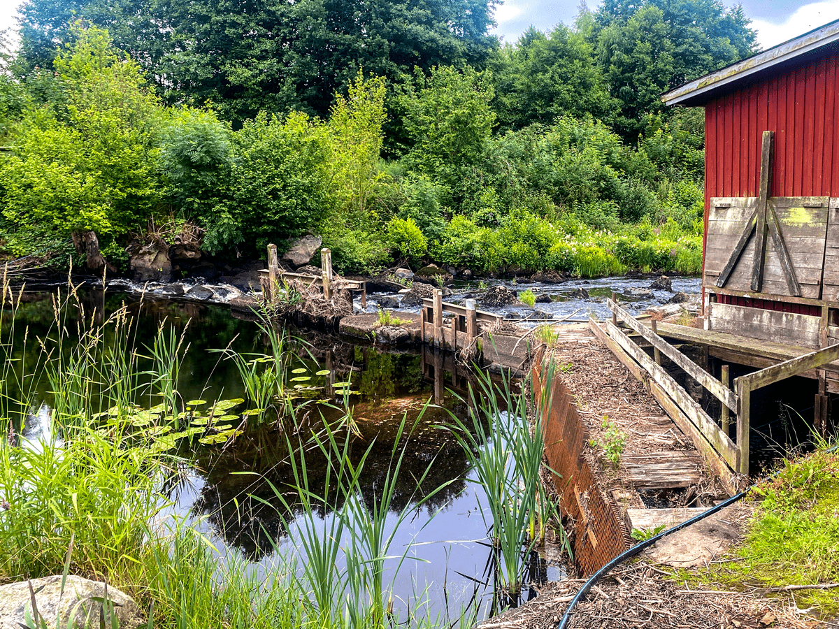
Monday 8 July I was invited by a friend to join a canoe trip on Holjeån, a small creek close to the village Näsum. We rented canoe and equipment from Wetlandi Canoe Center and started from Västanå Kvarn (mill).
Västanå Mill is one of the country’s oldest industrial facilities still in operation. Records (an invoice to the Danes) indicate that there has been a mill here since at least 1380. Although not as old, the stone bridge over the river just south of the mill is still impressive. The bridge is nearly 50 meters long, and since no traffic has been allowed since the 1950s, one can peacefully gaze over the river from the bridge.
Under the bridge we encountered our first challenge. When we should pass the small stream, I got the tip to try and “brake” as much as possible to avoid going to the right, that was apparently not a good idea. Maybe I braked too much since we went to the left and got suck on some rocks. Got loose and could continue to the next challenge.
After approximately 1 km down river there was a log across the river, under water. Since the water level was quite low we could not pass over it without some extra work. Climbed on to the part of the log that was over water and could drag the canoe over.
When entering Ivösjön the sky opened up and there was lots of rain, hale, wind, waves, thunder and lightning. Got a little nervous and we decided to paddle to the shore to take “shelter” (very limited but we were not on the lake). After half an hour it was gone and we could see the sun again and continue to the end station Klackabacken.
The distance from Västanå mill and Klackabacken is 7 km. A narrow river with fantastic and magical scenery.
It is a fascinating place. A former monastery, then a castle and now a hotel. It has a museum, an old monastery kitchen, a chapel, a beautiful park and som hiking trails. The night porter, Bosse, told us about the ghost Patrik, 10 years old, who is a friendly ghost that haunt the castle. He got a cold breath from a mun when Patrik saw him die, getting stuck in the water mill. One day Patrik was gone and they never found him. Many years later bones from a child was found in a well… If you visit the hotel and feel a chilled breeze, it could be Patrik.
The last couple of years the castle has been the scenery for the Swedish music program “Stjärnorna på slottet”.
This year I had the opportunity and pleasure to attend Juleløses Jul Christmas Eve together with Arun, colleague and friend from India. It is an event taking place every year since 1975 in the Grå Hal at Christiana, Copenhagen. Before 1975 Juleløses Jul took place at Copenhagen Town Hall. It’s a very old Christmas tradition in Copenhagen, started once upon a time by Socialdemokraterna, haven’t managed to find information about when.
Free food is served to more than 1.000 people. It was a very amusing and interesting experience and I was amazed by:
The amount and variety of people.
Decorations – ceiling filled with paper peace pigeons, a Santa dressed only with hat and underwear, a huge disco ball, light effects and much more.
Food – choice of vegetarian dish, sallad, beef and/or pork, Dessert was rice porridge with cinnamon sugar and/or cherry sauce. Beer, wine and soda is sold at the bar.
Entertainment – Storytelling by one of Santa’s elves about why there are summer, winter and Christmas. The priest had a sermon and a “choir” sang some hymns with the audience. A DJ and different groups played a vast variety of music genre.
Learned from Kirsten, at the Christiania Information Office Nyt Forum, that there are 100 volunteers that help out with the different tasks. There is no entrance fee and the food is free so the financial part is solved by applying for different funds and collecting money during the Christiania Christmas Market. They also get support from both Copenhagen Municipality and Her Majesty the Queen.
There are none or very little advertising and it is worth a visit.
Door opens at 17:00 (next year).
21-28 August Mickey and I visited the Greek island Limnos (Lemnos). The island is the 8th biggest in Greece, located in the center of the Northern Aegean sea.
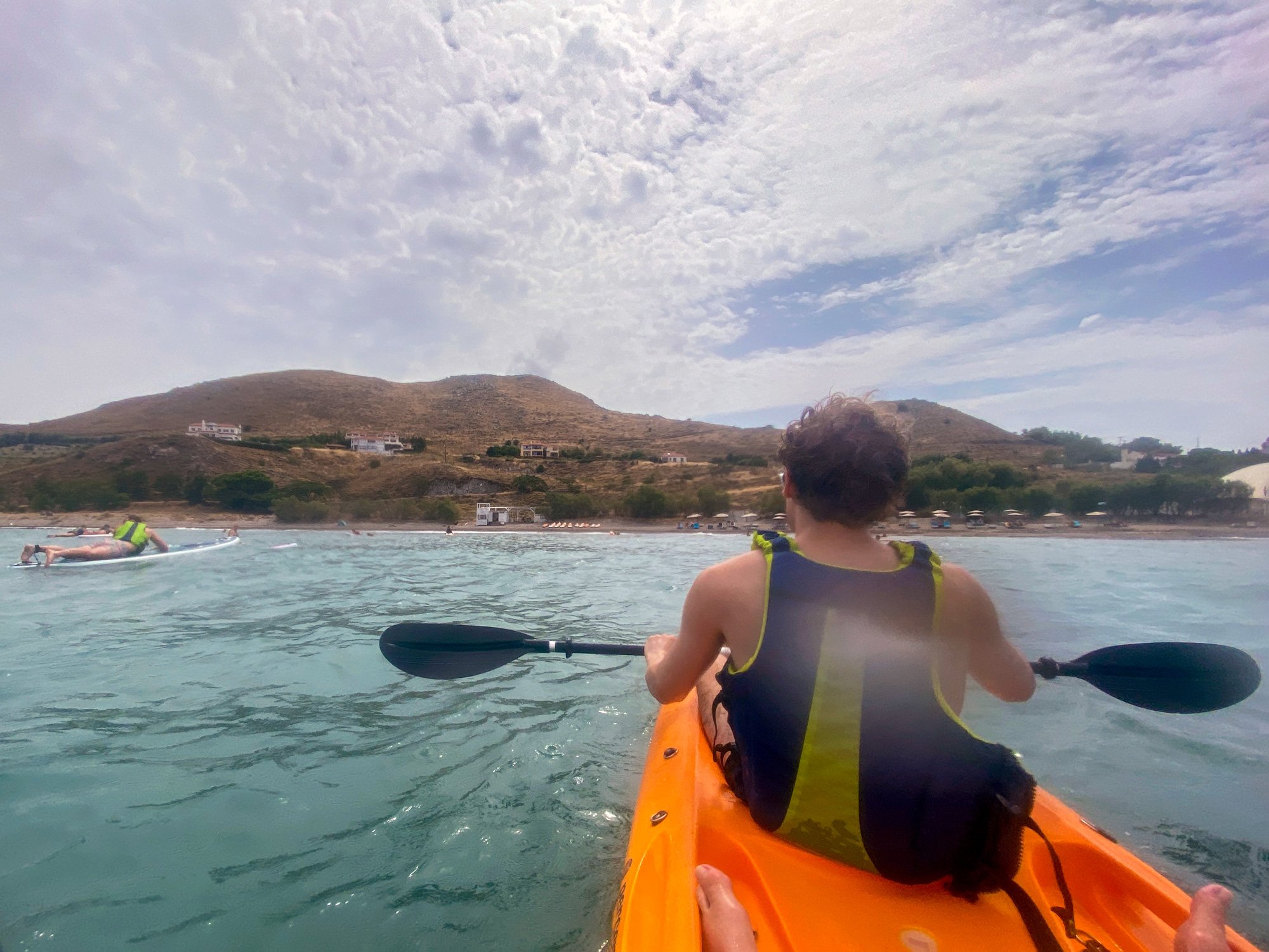
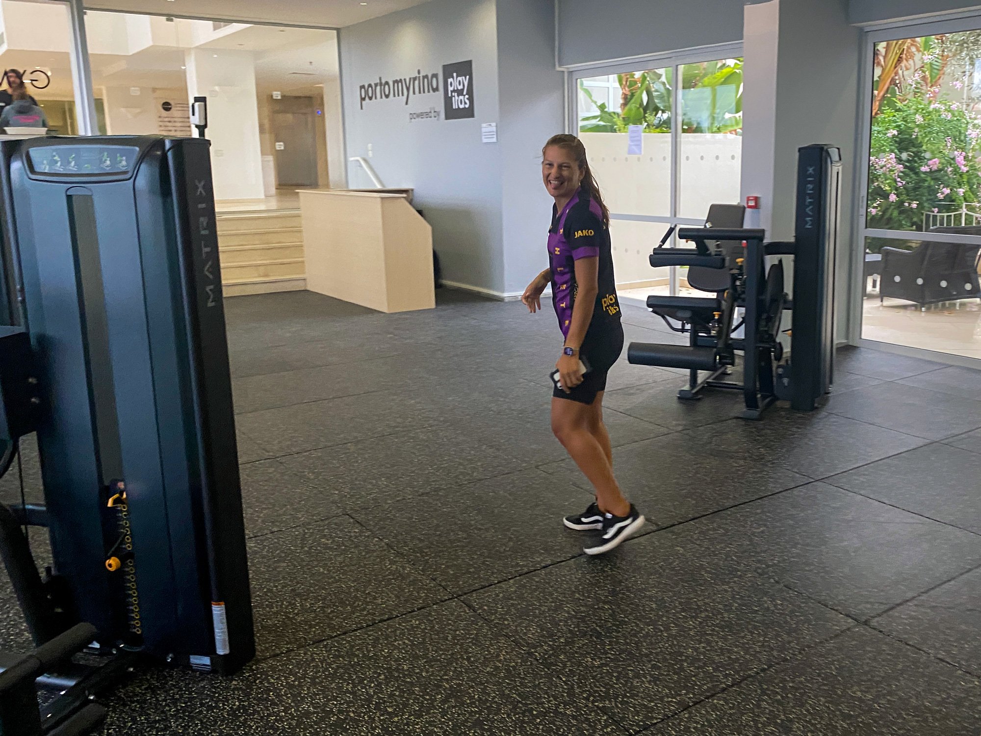
We travelled with Apollo and stayed at Porto Myrina, Powered by Playitas. The hotel had a lot of different sport activities included in the price. At some activities you could just up show at the set time, others you should sign up for. We tried Yoga, Padel, Scuba diving, kajak, SUP and did a lot of laps in the pool.
Tuesday we did a 12 km hike to the “Antenna hill”. Beautiful 360 degree view over the landscape from the top:
Wednesday we experience “extreme weather conditions” where there came a SMS warning!
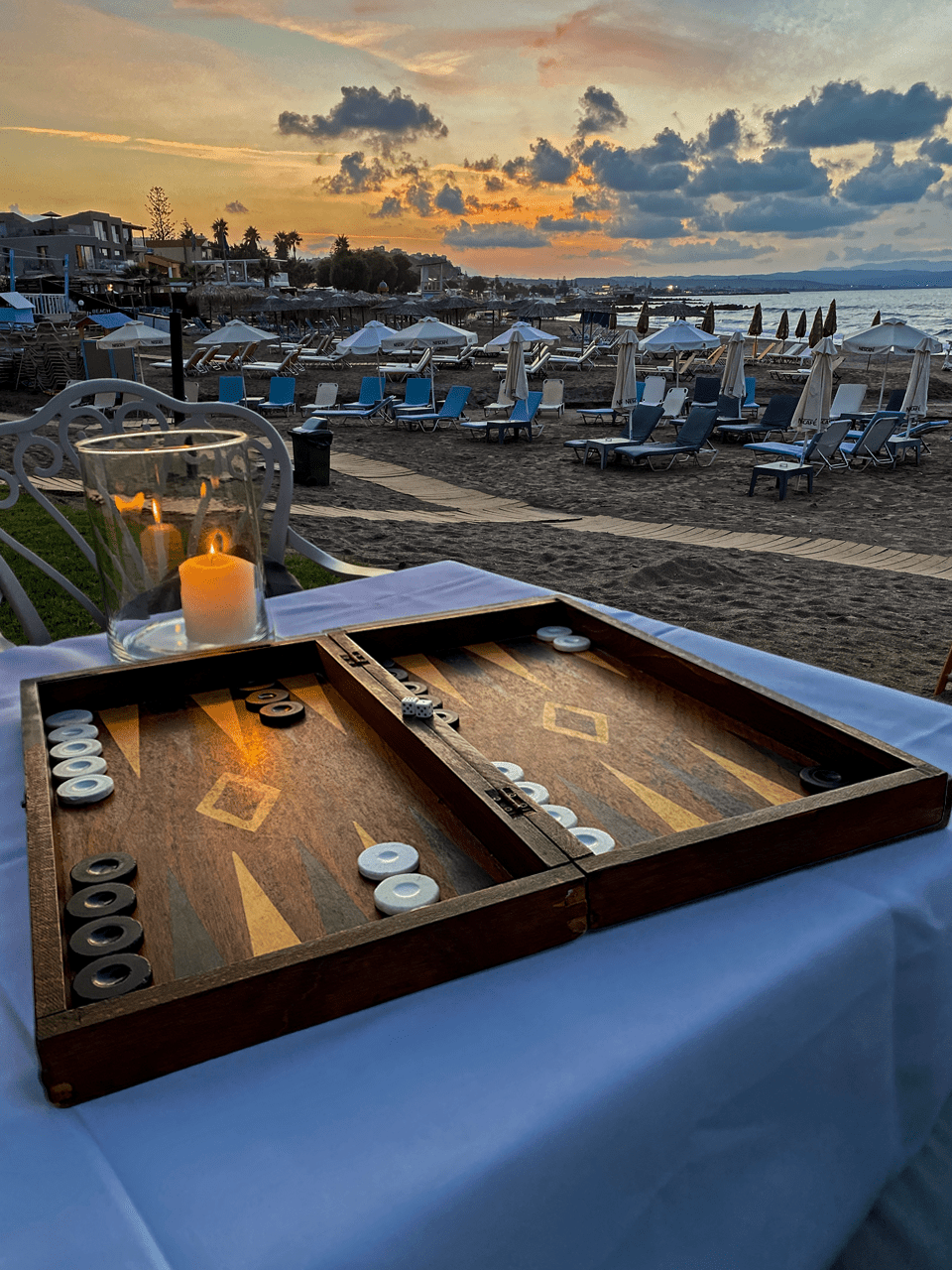
Spent the day playing backgammon and visit the fitness center:
Thursday we hiked up and around the Castle of Myrina, that could be considered as one of the most resistant and best fortresses in Greece:
Friday we rented a car (“jeep”) and drove around the island to see some of the sights – A dessert. Sand dunes (and a tank) at Gomati beach.
Extraordinary lava formations at Falacro and drove on some dirt roads – great fun! and might be the best sight of the day. A salt lake at Aliki, that was not white but muddy due to the rain storm.
Had lunch at the surf beach Keros. Should see some windmills at Kontias but probably also due to the storm, the path up to the windmills was closed. Many of the roads was very narrow, especially through the villages:
Saturday we did a 14 km hike to “The Church without roof” (Church of Panagia Kakaviotissa). This Greek Orthodox Church was built by refugee monks who fled to the mountain as early as around 1,416 AD and is one of its kind in the world.
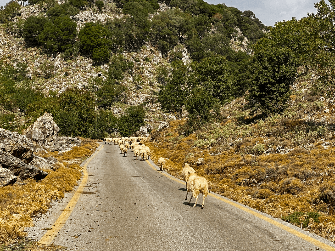
The track towards the church we choose an alternative route that Google maps marked as a path. In reality there was not much of a path, only the ones the sheep and goats had made. We used Google maps as a compass to help us keep on the right track. An exciting adventure.
Hiking back from the church, it was more or less roads and “the beaten track” all the way back to the hotel.
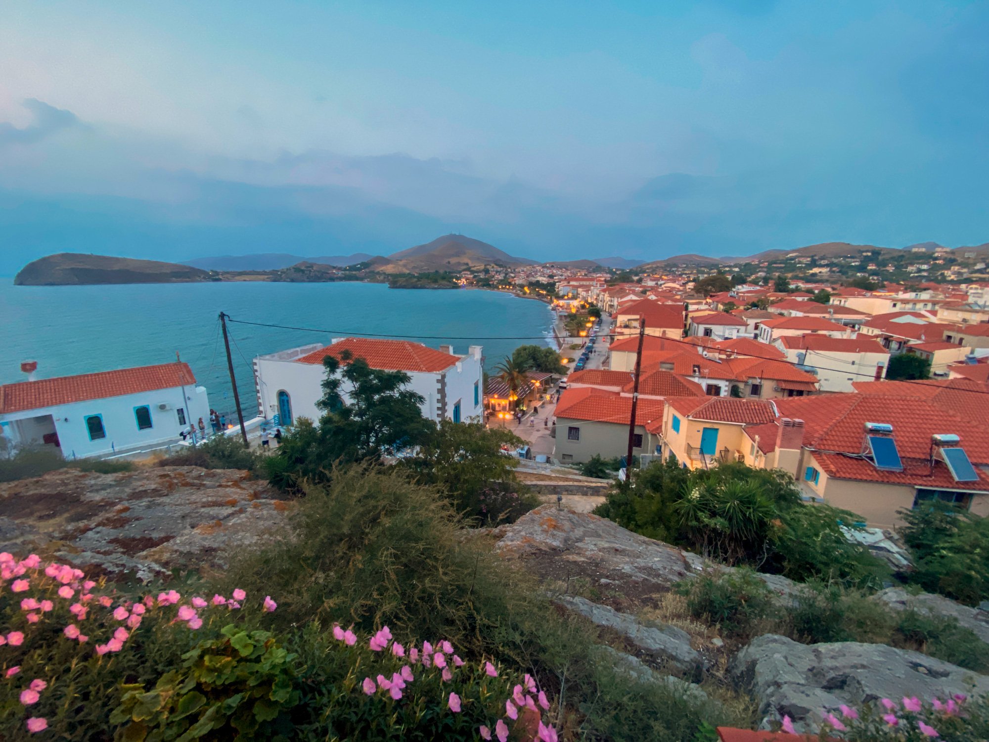
Myrina is the capital and main port of Lemnos and counts on 4500 inhabitants. The settlement stretches around two beautiful bays and between stands the imposing Venetian castle surrounded by massive formations of volcanic rock.
Visitors are charmed by the old neoclassical mansions, Ottoman buildings and fountains, traditional houses, narrow streets and modern constructions that compose the setting of Myrina. Along the waterfront lie plenty of restaurants and traditional taverns.
14-21 of October, Mickey and I visited the small beach resort Agia Marina, Crete, not far from Chania. We travelled with TUI and stayed at Atlantica Caldera Village, room no. 212 with a great view from the balcony, overlooking the village, sea and the island Agioi Theodoroi, a nature reserve inhabited by the Kri-Kri goat.
Here follow some stories and pictures of what we did during our stay, enjoy.
Walkabouts:
Beach walk Agia Marina – Palatinas, 8 km.
Hill walk Agia Marina – Cave Nerospilia, 8 km. (the cave was closed)
Beach walk Agia Marina – Chania, 11 km.
Chania is the capital of the Chania regional unit. It lies along the north west coast and consists of the city itself and several nearby villages.
On the way we had a break at Iguana Beach and passed Abandoned Graffiti House,
In Chania we walked along the Venetian Port, where we had lunch. We took the bus back to Agia Marina.
Bus day to Elafonisi:
Monday we went on a bus trip to the beach Elafonisi. The trip went via the gorge Topolia and a stop at Cave Agia Sofia (Wisdom of God) before we reached Elefonisi.
Here we spent a couple of hours walking around, swimming and relax on the beach. Elafonisi is an island when the tide is high and famous for it’s pink “sand”, that actually is seashells. Since many tourists have taken the sand with them home, there isn’t much left. The authorities have strengthen the rules and set high penalty for removing the sand.
Many thanks to our guide Joanna, who told many good stories about the culture of Crete and the scenery we passed through.
Beach walk at Elafonisi, 2 km.
Rent-a-car day:
Wednesday we rented a VW Up from a local travel agency, Beyond Travel, on the main street in Agia Marina.
The journey: Agia Mariana – Gorge of Imbros – Hora Sfakion – Frangokastello – Giorgioupoli – Kourna Lake – Agia Marina.
The gorge of Imbros is the second most popular gorge, after Samaria. for walkers on Crete. The gorge of Imbros was the main route through which Allied Forces evacuated Crete in late May 1941 after losing the Battle of Crete. Close to 20.000 troops (mainly New Zealanders, Australians and Brits) headed from the North of the island through the gorge of Imbros to Komitades and Hora Sfakion where they were due to be picked up by ships and taken to Egypt. About 13.000 made it onto ships. The rest were made prisoners by the Germans or escaped to the hills. There is a monument in Hora Sfakion commemorating these events.
Hora Sfakion is a small village with a main harbour front of tavernas, two minimarkets, a butcher, and a bakery. There is a quiet local beach immediately west of the village, and several pebbly beaches nearby. Hóra Sfakíon has a variety of tourist accommodations: rooms, studios, and apartments. The local economy is based on tourism, fishing, olive-oil production, and sheep and goat herding.
28 May – 1 June, 1941, British and Australian forces was evacuated from this bay after passing the the gorge of Imbros.
Frangokastello is a castle and scattered settlement on the south coast of Crete. The castle was built by the Venetians in 1371–1374 as a garrison to impose order on the rebellious Sfakia region, to deter pirates, and to protect Venetian nobles and their properties.
Returning to the north coast, Mickey found an alternative way on Google Maps. A small winding road with around 25 hairpin turns. I admit I was little nervous driving up this road. Very steep, narrow, no crash barrier, parts of the road broken and fallen off on one side, stones and rocks fallen on to the road on the other. Glad we didn’t meet any cars…
Due to the narrow road and suffering from a little bit anxiety, I “forgot” to take photos of the beautiful scenery. Found this picture on Google Maps.
Credit: Wolfgang Johannes
Formerly a small fishing village, Georgioupolis is more of tourist town now. The town square is surrounded by outdoor seating. The 9 km beach is the main attraction of the area with the church of Agios Nikolaos on the islet with the same name. Here you also find a small harbor at Turtle River, where you can rent different kind of boats to go up the river or out on the sea.
Nearby Kourna Lake is a popular excursion.
Kourna Lake is the only natural freshwater lake on Crete. It covers an area of 579 acres and maximum depth reaches 22 meters. The lake is a protected area as an important wetland with many species like moorhens, ducks, eels, snakes and a rare two-color turtle and occasionally herons.
Beach day:
A day spent at Gorgona Beach Club with sun, backgammon and bodysurfing in the quite big waves. Thanks to Director Alex and staff, for friendly and good service (and for use of your backgammon).
Restaurants Agia Marina:
These are the restaurants we tried. Dessert and raki served was the custom when paying the bill. “Raki is like Ouzo, but worse” – statement from a waitress.
Botonis – Grilled pork chops. The wood fired “globe grill” was standing in the restaurant
Neraida – Mixed grill, more than enough for two (got doggie bag for lunch next day)
Nostos – Ingo: Moussaka, Mickey: chicken gyros
Olivi – Both had very nice beef steaks with great “potato salad” (potato mixed with garlic, lemon and parsley)
28 August 2016 I had the pleasure of hiking The Caminito del Rey together with Mar, Andreea, Renny and Peter.
Caminito del Rey is located approx. one hour drive from Malaga.
After the drive from Benalamadena, we had a very nice lunch at El Mirador. The restaurant has a fantastic view over the lake. Bring swimming clothes for a dip in the lake, before or/and after the walk.
The total length of El Caminito del Rey is 7.7 km. It’s divided into a 4.8 km long access way and a 2.9 km long walkway that you need a ticket to visit.
The walkway of Caminito del Rey, called El Hoyo, is of spectacular natural beauty, breathtaking and fantastic. The path is more than just a walk in the hills. Parts of the walkway is a hanging footbridge that rises over 100 metres above the river below with steep walls, that can make you feel dizzy. The path is “hazardous” because of the heights and its narrow parts. It was rebuilt so it could be used for active tourism in the natural surroundings. It requires certain level of physical effort and skilfulness. You are not risking your life at all, but be aware of the strong impressions this place might have on you. That’s why this path is so spectacular.
It’s a good idea to book in advance to access the walkway. They let in 50 persons every ½ hour.
Note!The Caminito del Rey is linear, not circular. You need to make sure to come back to the start on your own. There are coaches between the northern access (Ardales) and the southern one (El Chorro), which go in both directions.
History
The walkway was originally built to provide workers at the hydroelectric power plants at Chorro Falls and Gaitanejo Falls with a means to cross between them, to provide for transport of materials, and to facilitate inspection and maintenance of the channel.
The construction began in 1901 and was finished in 1905. The original path was constructed of concrete and rested on steel rails supported by stanchions built at around 45 degrees into the rock face. An extra benefit with the path was that it created great joy for the locals that experienced easier access between the neighboring villages.
According to a local guide (that also was in the construction team for the new version) told us that approx. 200 persons died during the construction of the original walkway (the number of casualties was zero, building the new one).
King Alfonso XIII crossed the walkway in 1921 for the inauguration of the dam Conde del Guadalhorce and it became known by its present name – “The Kings Pathway“.
The old walkway deteriorated over the years and there were numerous sections where parts or all of the concrete top had collapsed. The result was large gaps bridged only by narrow steel beams or other supports. Few of the original handrails existed although a safety wire ran along the path. Several people lost their lives on the walkway and after two fatal accidents in 1999 and 2000, the local government closed both entrances. Even so, in the 4 years to 2013, four people died attempting to climb the gorge. It was known as the “The most dangerous walkway in the world”.
In March 2014, the cornerstone of the rehabilitation project was laid by specialized alpinists. The new walkway reopened on 29 March 2015.
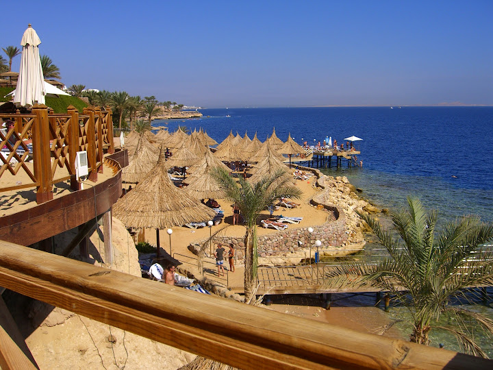
The resort doesn’t have a “normal” beach. It has a couple of jetties sticking out over the coral reef and end at the reef wall. A stair leads down to a fantastic underwater world.
The “beach” area is built up in levels with beach beds and umbrellas. It’s a rustique, marine like style that I found suited the area well.High heels and other walking obsticales could be a challenge with many stairs, sand and cobble stone.
I was surprised that even since the hotel was from ’97 the reef was ok “healthy” with lots of colorful fish and coral. A life guard on each jetty was also efficient to whistle when people didn’t behave and went outside marked area etc.
The actual reef is a approx 8 m deep wall. We saw lots of different fish along the 200 m, incl. Lionfish, Napoleon fish, Bannerfish etc.
The pool area was big with a “lazy river”, a 300 m long “river” that was “running” in a circle around the pool area.
We took the hotel shuttle bus to Naama Bay one afternoon and walked around the main street and board walk.Very loud and busy with the different bars competing who could play the worst music as loud as possible. The Egyptian sales men are VERY eager and like glue to you. Learned that you shouldn’t even say “no thank you” insted totally ignore them…Had dinner at restaurant Dannaneer, that was recommended by the guide. Nice and cheap steaks.
Tuesday was Jeep safari. Offroad through the dessert with an exciting driver that preffered the off offroad.First stop was a Bedouin graveyard where the guide, Rasmus, told some stories. For instance how marriage works: From when the daughter is 13 years old, the father puts a green flag on the door. Interested men visit the home. The daughter make and serve tea to the man. If the tea is sweet he is approved, if the tea is bitter and strong it’s a “no go”…
Second stop was Dahab where we should pick up snorkeling gear to the ones that didn’t had any.These houses the government built for the Bedouins some 4 years ago. Many of the Bedouins prefer to live their own life in tents and home made sheds like they always had. Half of the houses are empty and the area is not finished and looks like some sort of ghost town.
Third stop was a camel ride to the Blue Hole.One of the myths about camels is that the camel stores water in its hump. The truth is the hump is a fatty deposit that provides energy when food is scarce.The camel stores water in its blood stream. It’s capable of losing forty percent of its body’s weight before becoming distressed and is able to go five to seven days before having to drink. The amount it drinks can add up to 80 l. in about 10 minutes.The camel’s mouth is tough and rubbery so that thorns and branches won’t damage it. The thirty-four sharp teeth allow it to bite off tough bites of almost anything, and when forage is short a camel can subsist on meats, skin and bones. Camels have three stomachs. They don’t chew their food but eat by swallowing their food whole and allowing it to be partially digested by the stomachs before being chewed as a cud later.
The Blue Hole is a very special place. I thought it was out in the sea but no, it’s just a couple of meters off the beach. A coral reef formed as a circle with a 120 meter hole in the middle.In the middle there is a rope across where free divers train and try to get as deep as possible. Some succed some doesn’t. On the cliff wall there are signs with the names of the ones that didn’t come up again and is still lying on the bottom of the hole. It’s has the nickname “Diver’s Cemetery”.We passed the signs and walked around the cliff on the image. There we started the snorkel tour. Ended with circle the Blue Hole and on the right side there is a underwater plateau that was beautiful.
Last stop on this adventures day was The 3 Pools just out side Dahab. also here the reef was just of the beach. One of our favorites was the “tower corals”. Highrise coral reef sticking up from the bottom. Lots of activity and fantastic colors.
Thursday we went on a snorkel/diving boat trip with Colona Divers. Leaving early in the morning to Sharks Bay were we entered the boat that should take us out to 3 different reefs in the Tiran straight.This image is from Gordon reef where this russian ship collided with the reef some 11 years ago coz the captain had too much vodka.We also visited Jackson reef and Raz Gamilla. At the last one we had a drift snorkel tour that was a fantastic experience. We jumped from the boat at one end of the reef while the boat still was drifting. The current took us floating along the reef for an hour and all we had to do was to “steer” so we didn’t hit the reef. We saw Barracuda, free swimming Moray eel (apparently very unusual), giant Puffer fish and lots of other fish.


